Tuesday, May 31, 2016

Day 16 – Watson Lake, YT to Whitehorse, YT

We continued the journey toward Alaska today.  We’re now about a day’s drive from the AK border.

The Route
We followed the Alaska Highway (YT-1) for 259 miles from Watson Lake to Whitehorse. Interestingly, the route snaked in and out of British Columbia with no signage to announce leaving or reentering the Yukon Territory.

We crossed the continental divide near Rancheria and traveled along the Swift River, Teslin Lake and Marsh Lake.

About the Day
We awoke to a sunny morning and were on the road by 9:30am.

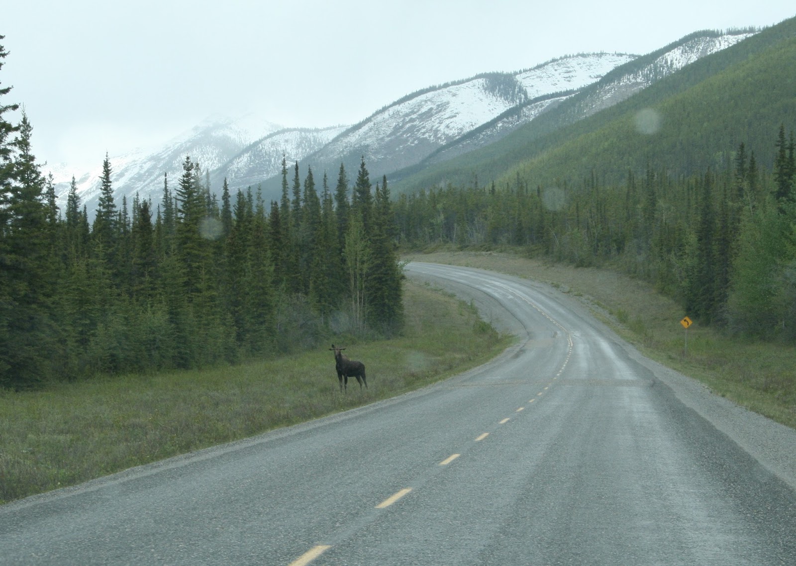
Scenes along the way …
YT-1 heads west
It’s pretty desolate
View of the Cassiar Mountains
The highway just goes and goes.

We met Doug and Linda Holt at a viewpoint outside Teslin. They’re from Hot Springs Village, AR (which is kind of near where Dick’s sister Bobbie lives). Doug has traveled the Alaska Highway fourteen times and has never driven the Top of the World Highway.
Hi to Jim and Bobbie from the Yukon!

Teslin was the largest town we passed and it wasn’t very big.
Bridge to Teslin

Yukon River as we approached Whitehorse

Highway conditions …
Today was much like yesterday with many long stretches of pretty good road and a number of rough sections where the surface was being rebuilt. The construction areas came with stopped traffic, loose gravel, rutted surfaces and lots of dust.
There's nothing like tank truck dust to make your day.

Did you know?
The YT covers 186,661 square miles and has a population of 37,566 with 27,678 residing in the capital of Whitehorse.

The YT maintains 3,014 miles of highway … 7.2% is paved, 51.3% is bituminous surface treatment (BST) and 51.3% is gravel. Paved surfaces feel like driving on silk compared to BST and clean vehicles are rare.

The YT is the only state or province we’ve seen where RV campgrounds offer RV wash facilities.
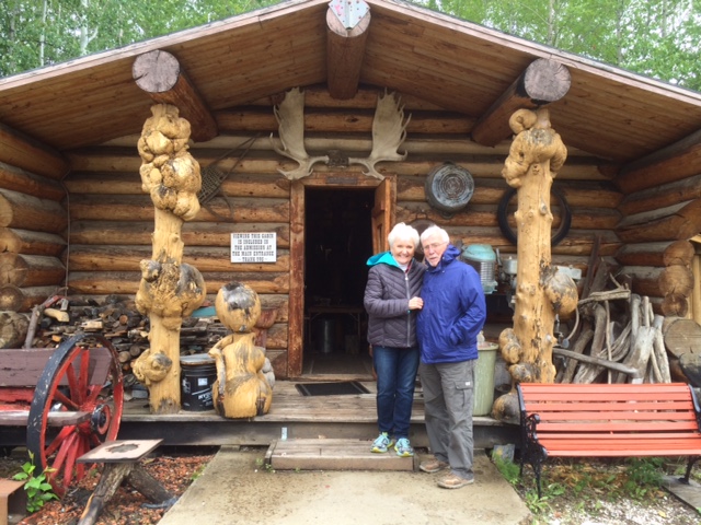
The Campground
We’re staying at Pioneer RV Park in Whitehorse. We chose a site surrounded by trees on a hillside ... very pretty and peaceful.
Site #134

Tomorrow
We’ll learn some more about Whitehorse and use Tim Horton’s for an internet connection.


Monday, May 30, 2016

Day 15 – Fort Nelson, BC to Watson Lake, YT


Today was a great day for a long drive to the Yukon Territory … with some fun stops and beautiful scenes of the Northern Rockies wilderness.

The Route
Follow the Alaska Highway from Fort Nelson, BC for 332 miles to Watson Lake, YT. This translates to follow BC-97 north to the Yukon Territory, then go west on YT-1.

We crossed Summit Pass (at 4,250 ft. it’s the highest elevation on the Alaska Highway) and Muncho Pass (3,593 ft.), passed through the small communities of Toad River, Coal River, Fireside, and Contact Creek, and drove along Summit Lake, Toad River, Muncho Lake and Laird River.

About the Day
We awoke to a sunny morning and were on the road by 8:15am.

Remnants of yesterday’s snowfall greeted us as we climbed over Summit Pass.
Climbing
Descending
Summit Lake
The descent continues

We got gas and had a great homemade breakfast at Rocky Mountain Lodge at mile 397. It was the first gas available in the 97 miles since leaving Fort Nelson.

Muncho Lake
Deep valleys
Sheer cliffs

Highway conditions …
  * All of yesterday’s snow had been cleared.
  * Traffic was light.
  * Loose gravel and rough roads were well marked.
  * Pot holes were the hardest to see before being right on top of them.

We hit two long stretches of road construction. One involved replacing the entire surface and the other involved redirecting and rebuilding a portion of the highway. Both were deeply rutted. We learned what to watch for very quickly.
This section is being completely rebuilt.

The highway straightens out as we descend toward the Yukon Territory.


Sightings
1 moose

1 black bear ... trust us on this one, no picture


5 bison (not buffalo)

Did you know?
Approximately 100 people live along the 319 mile section of the Alaska Highway between Fort Nelson, BC and Watson Lake, YT. It's a pretty remote area.

Sign Post Forest is Watson Lake’s most famous attraction. It was started by a homesick G.I. in 1942.
Signs of the times in Watson Lake


There was no cell phone service until we got into Watson Lake.

It's pretty light here at 11pm.

The Campground
We’re staying at Baby Nugget RV Park, 14 miles west of Watson Lake on the Alaska Highway.
Site #2

The campground has a very good restaurant called Wolf It Down. Chef Dave has many years of experience and awards to match. We think Wolf It Down should be a must for anyone passing this way.

Whisker Fun
Week 2
Hmm, this beard is just scratching the surface.

Sunday, May 29, 2016

Day 14 – Fort Nelson, BC (Day 2)

We stayed put and regrouped today.

The Route
Just wandered around town.

About the Day
It rained lightly all night. Our duct-taped plastic bag fan cover kept Carol dry and the furnace kept us toasty warm.

We awoke to a gray, rainy, 36°F morning.

We learned the decision to stay here another day was wise. A foot of snow fell along the route to Watson Lake. Travel north today is not recommended.

We went to Tim Horton’s for lunch where we met a man from the Nashville area traveling to the Arctic Circle by motorcycle. We see it as a really gutsy trip.

Next we stopped at the Northern Rockies Visitor Centre and the Fort Nelson Heritage Museum.
Museum entrance
A small part of the collection
A mystery - a silver set, in a trunk, in a well
Trappers cabin
Dick checks out an early Prius
Museum’s location on the Alaska Highway

The museum was fun and very interesting. However, the warm trailer was certainly a welcome sight after walking around in the cold museum.

Did you know?
The North West Fur Trading Company established Fort Nelson in 1805.

Fort Nelson was named in honor of the British Lord Horatio Nelson who won the Battle of Trafalgar.

Fort Nelson is located on its 5th site … the previous four were vacated due to floods, fires and feuds.

Fort Nelson was the original “Zero” on the Alaska Highway. It was only after the highway was opened to the public that Dawson Creek was named “Mile 0”, because it was the Highway’s southernmost point. The stretch from Dawson Creek to Fort Nelson existed before the Alaska Highway construction began.

The Campground
Site #62 at Triple G Hideaway

Looking Ahead

The temperature is supposed to reach the mid-50’s tomorrow. It’ll be time to move on.

Saturday, May 28, 2016

Day 13 – Fort St John, BC to Fort Nelson, BC

Mother Nature gave us kind of a hard day at the office.

The Route
Today’s route was simple … drive north on the Alaska Highway and stop at Fort Nelson 233 miles later.

About the Day
Today’s story began last night. It rained all night.

We awoke to a gray, rainy, 37°F morning. Carol discovered a leak in the rear vent fan and some wet spots on the bed. We dried things as best we could, laid out some plastic bags for temporary protection and headed out.

We stopped for breakfast at The Shepherds Inn just north of St. John. The service and our meals were excellent. They served phenomenal homemade bread.
The Shepherds Inn is a treasure in the middle of nowhere

The temperature dropped to 30°F and the rain switched to snow while we were in the restaurant.

The engine check light came on when we left the restaurant. Since there was no one to diagnose the problem, we decided to drive on to Fort Nelson. Unknown to us, the Durango’s monitoring system had reported the problem and sent us an email describing the problem and offering possible solutions. We read the email when we got to Fort Nelson, closed the gas refill door tightly and the engine check light went out. Isn’t technology wonderful?

We spotted forest fire damage shortly after leaving The Shepherds Inn.
The snow will soon hide much of the fire damage.

The weather got worse quickly. We drove nearly 200 miles in this stuff.
The snow looked pretty at first.
There wasn't much traffic.
This view gets a bit tiring after a 100 miles or so.

The Durango’s outside temperature sensor froze and began displaying errant temperatures (like 122°F). It resolved itself when we got out of the freezing snow.

The trailer got plastered with snow and slush from passing semis.
The Airstream met its first snow

We saw very little of the scenery today.

The Campground
We’re staying at Triple G Hideaway RV Park. It’s very well run, offers the basic services and has an excellent restaurant. Carol picked it from the two available in the area. Lots of RVers have pulled in all afternoon. They obviously agree with Carol.

Now what?
We had rain, a leak, an engine check light, snow, bad driving conditions, and a frozen sensor today. What else? Well … we ran out of propane while getting set up in Fort Nelson. Everything was endured or resolved except the fan leak.

Looking Ahead
The route to Watson Lake takes us over the highest elevation on the Alaska Highway. The weather tomorrow is supposed to be much like today with the possibility of worse driving conditions. We’re going to stay in Fort Nelson another day hoping for warmer weather.

Our new plan becomes:
Watson Lake, YT on Monday
Whitehorse, YT on Tuesday and Wednesday
Dawson City, YT on Thursday and Friday
Return to the US in Alaska on Saturday

Friday, May 27, 2016

Day 12 – Grande Prairie, AB to Fort St John, BC

We’ve driven over 2,800 miles and found out today that we’ve only just made it to “Mile 0” of the Alaska Highway.

The Route.
We took AB-43 west from Grande Prairie to the British Columbia border where the route changed to BC-2. We then followed BC-2 to Dawson Creek where we connected with the southern terminus of the Alaska Highway (BC-97) and continued on it to Fort St. John. Total driving distance was 141 miles.

About the Day
Today was mostly sunny with temperatures reaching the low 50’s.

Scenes from AB …
A memory from Beaverlodge, AB
AB-43 offers lots of road and lots of trees

Scenes from BC …
It’s time to turn back the clocks
BC-2 offers more of the same

Dawson Creek played a critical role in building the Alaska Highway and makes sure everyone knows it.
Arch at entrance to BC-97
We’ve come a long way to just get started
Plaque at the Arch
The original milepost
New milepost installed in 1946 after a car hit the original

We planned to stay the night in Dawson Creek. However, the short driving distance, gaining an hour with the time change and limited interest after arriving in Dawson Creek prompted us to drive on to Fort St. John.

The approach to Fort St. John made it clear we were deep in oil exploration country. We descended into the Peace River valley and saw a large refinery by the river and a pipeline spanning it.
The Alaska Highway descends into the Peace River valley
Bridge, refinery and pipeline come into view

The Campground
The Ross H. MacLean Rotary RV Park is just outside Fort St. John on Charlie Lake. It’s nice. Its overcast, cool, windy and raining lightly tonight.
Site #25

Looking Ahead
Fort Nelson, BC tomorrow
Watson Lake, YT on Sunday
Whitehorse, YT on Monday and Tuesday
Dawson City, YT on Wednesday and Thursday
Return to the US in Alaska on Friday

Thursday, May 26, 2016

Day 11 – Stony Plain, AB to Grande Prairie, AB

The drive along AB-43 to Grande Prairie is pretty boring, much like an east-west trip through Kansas. The country is beautiful and the road is in good condition, but there’s just a lot of both to see.

The Route.
We took AB-16A westbound from Stony Plain to TCH-16 (Yellowhead Highway), continued on TCH-16 a few miles to AB-43, and then followed AB-43 northwest to Grande Prairie. Total drive distance was 274 miles.

About the Day
The day began with sun and clear skies. Showers came and went as we drove and the temperature fluctuated between 46 and 66 degrees.

There were very few advertisements along the highway. At first we thought there might be some kind of sign restriction. Then we realized there was nothing to advertise because there were very few towns and limited services along the way.

Views along AB-43 …
South of Onoway
An impressive wood timber train trestle
There was lots of road and wilderness today
Speed limit of 110?
Oops - 110 kph is 68.35 mph
Can we say we saw a moose today?

The Campground
Camp Tamarack RV Park is quite nice. The staff is friendly and very professional. Our gravel site is level and all services work really well. The park is very clean and quiet.
The entrance is on a service road just off AB-40.
Setting up at Site #5

Tomorrow

We enter British Columbia and a new time zone tomorrow and will stop in Dawson Creek.