Thursday, June 30, 2016

Day 46 – Prince George, BC to Hope, BC

We had the longest drive of the trip today. It held some delightful surprises.

The Route
We took BC-97 south from Prince George to Cache Creek where we connected with TCH-1 which took us on south to Hope. It was a 388 mile day.

About the Day
We awoke to overcast and light misting rain that was hanging around after a late night shower. The sun broke through early and we had a delightful travel day.

Along the Way
Our landscape scenes changed dramatically as we followed the Fraser River. Traffic volume has been increasing each day. It may be a holiday weekend effect. Tomorrow is Canada Day and this is the 4th of July weekend.

The small city of Quesnel was the first treat of the day. It’s a very finished, attractive and prosperous community with a huge lumber mill. What do they do with the mountains of sawdust?

The Cariboo Wood Shop (at McLeese Lake) offered many interesting treats. The fresh fudge attracted us and the gift options hooked us. We left with some of both. Carol was delighted.

Scenes ...
We saw gentle fields, rolling hills, deep canyons and a wide Fraser River as we continued south.
Fraser River
Boat travel was possible north of Williams Lake.
The highway continues to overlook the river.
Williams Lake
Hills emerge and seem to grow.
The landscape gets more arid.

There was a fire along TCH-1 at Lytton. It was well under control when we passed.

Fraser Canyon …
The route from Prince George to Hope goes through Fraser Canyon. We didn’t know of it before today and were delighted by 52 miles of awesome views that guided us into Hope. 

The chasm begins to show itself near Cache Creek and grows from there. We didn't get pictures that show the depth of the chasm or the highway clinging to the side of steep mountainsides. In our opinion, the experience ranks right up there with the Grand Canyon.

We think it's best if seen by traveling south.
It’s an interesting descent.
The descent seems to go on and on.
There are 7 highway tunnels
... and even more train tunnels
Train tracks line both sides of the river.
This is an exciting drive 
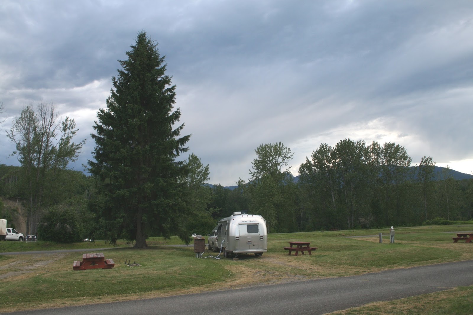
The Campground
We’re staying at the Hope Valley Campground, just off TCH-1 east of Hope. It's OK, but nothing special. 

The place is packed as everyone prepares for the holiday. RVs of all sizes and shapes are jammed into every conceivable space. We got one of the last sites available. The first place we tried was full.

Surprisingly, the evening has been very peaceful.

Tomorrow and After
Tomorrow - we’ll return to the U.S. via the Abbotsford border crossing.

Saturday - we'll visit Jon and Judy Siehl in Seattle.

Sunday - we'll arrive in Portland and stay put for a while.

Wednesday, June 29, 2016

Day 45 – Hazelton, BC to Prince George, BC

It feels like we’re really coming out of the wilderness. Towns are larger and closer together. Services are available and more varied. Scenery is more subdued.

The Route
We drove 277 miles on TCH-16 from Hazelton to Prince George and took BC-97 south 8 miles to the campground. The highways were in excellent condition.

About the Day
We did some cleaning and ended up leaving later than usual.

It was mostly sunny with a late afternoon thunderstorm near Vanderhoof. The temperature reached the low 80’s.

Along the Way
We left the Hazeltons with good memories. New Hazelton provided the final memory with a sweet touch at Skeena Bakery … a non-profit that specializes in hand-crafted breads and pastries. Carol’s cinnamon roll and my lemon-chocolate muffin were delicious.
 

Our morning drive was decorated by snow-capped mountains.

Storm clouds formed over the mountains in the afternoon.

We had lightning and a heavy downpour for about 15 minutes near Vanderhoof. Some of our Alaska and Yukon highway dust finally got washed off.

The dramatic mountains gradually disappeared.

The sky began to clear as we approached Prince George.

Travel Tidbits
Vanderhoof is the geographical center of British Columbia.

We drove through Smithers and Burns Lake. Both were vibrant and attractive.

We saw our first Tim Hortons since Whitehorse in Smithers. That means some have waited 778 miles for a visit to Tim's.

The Campground
We’re at the Bee Lazee RV Park, 8 miles south of Prince George on Hwy 97. It’s nice, clean and managed by nice folks.
Entrance
Site #10

Tomorrow
We have a long drive to Hope, BC.

Tuesday, June 28, 2016

Day 44 – Hazelton, BC (Day 2)

A few days ago we only knew Hazelton as a name by a dot on a map of British Columbia. That changed today.

The Route
We drove the 31 miles to and from Kitwanga on TCH-16 and then explored Hazelton, New Hazelton and Old Hazelton. We didn’t stop in South Hazelton.

About the Day
It was sunny all day with a pleasant breeze. The temperature reached 81°.

We set off to see totem poles in the area and to learn about the First Nation culture that created them. The research included trying to figure out why there are four communities in the area with “Hazelton” included in their name.

The area is strongly influenced by centuries of First Nations language and culture. The vocabulary here consists of strange sounding names and locations combined with those from non-aboriginal influences. Places like Hazelton, New Hazelton, Old Hazelton and South Hazelton didn’t exist until gold rushes, telegraphs, steamboats, and railroads invaded the area.

Along the Way

Hagwilget Suspension Bridge …
The bridge is a critical link between New Hazelton and Old Hazelton. It spans a deep canyon created by the Bulkley River. We crossed it to get from TCH-16 to our campground and as we explored today.
The early bridge
It’s a single-lane bridge
With some great views

Visiting Kitwanga …
Kitwanga means “the people of the place of rabbits” in the Gitxsan language. It’s a long-standing village within the Gitwangak Indian Reserve. Gitwangak totems were placed here in 1926 after restoration.
St. Paul’s Anglican Church (1893)
 & Bell Tower (Rebuilt 1979)

Visiting Kispiox …
Kispiox is a Gitxsan village located a few miles outside Old Hazelton. The original name of Kispiox Village is Anspay’axw which means “the people of the hiding place” in the Gitxsan language. Kispiox is renowned for its master carvers, totems and scenic setting.
A failed project helped the village
16 extraordinary totems
Each in different stages of completion
Pierce Memorial United Church (1895)
Lots of history is abandoned here

Observation: This culture doesn’t dispose of unwanted items. They just abandon them where they were set, dropped or parked.

Visiting ‘Ksan Historical Village and Museum …
‘Ksan is a reconstructed Gitxsan village. The village and museum are next to our campground and near the ancient village of Gitanmaax. It was populated by the Gitxsan Aboriginal people. They have a very nice display of longhouses, artifacts and traditional totems. There are houses for each of the four Gitxsan clans.
Totems are constructed
 from cedar logs.
 

Visiting Old Hazelton …
Old Hazelton proudly displays its history as one of the oldest pioneer communities in the northwest. It was named after the hazel bushes in the area. The Hazelton Pioneer Museum describes the people and events that shaped the region.
A big name in Hazelton history
Sternwheelers played a big part in Hazelton's
reputation as a booming supply center.
Skeena River flows past Hazelton's waterfront

The Campground
We’ve found the campground to be very attractive and peaceful. Surprisingly, it would be pretty vacant if it weren’t for large group of tree growers.
Views from last night …
Site #26
Some of the tree planters
A very nice night

Tomorrow
We’re off to Prince George.

Monday, June 27, 2016

Day 43 – Iskut, BC to Hazelton, BC

We escaped from a technology black hole today. We now have a cell phone signal and access to a usable internet connection. Up here, technology doesn't reach into the wilderness ... people have to drive miles to report an accident.

The Route
We continued southward on the remaining 251 miles of Cassiar Highway, connected with TCH-16 at Kitwanga, and drove northeast on it for 35 miles to Hazelton.

Interestingly, Cassiar Highway’s personality gradually changed as we traveled south toward more populous areas. Center and edge lines appeared and the highway condition seemed to improve … it got wider and the rough spots became less frequent.

About the Day
It was sunny all day. The temperature reached 80°.

Along the Way
Heading out …
It's time to move on.
We could pick a new favorite lake every morning.

Cassiar Highway has lonely stretches …

Moments of reflection at Kinaskan Lake Provincial Park …
 

Other scenes …
Mountains, forests, lakes and rivers surround us.
There’s a treat over every hill
It’s like peering into the depths of wilderness.

Sightings …
A rabbit at Kinaskan Lake

We had three black bear sightings along the highway. They popped up from or were playing in the tall grass and flowers along the berm. The cubs looked just like cuddly teddy bears with big, black curious eyes. They were adorable.
1 – a single cub
2 – a mother and two small cubs
3 – an adult

The Campground
We’re at ‘Ksan Campground in Hazelton. It looks like a community campground, but it’s obviously a native culture venture. It’s nicely maintained and has the best internet service we’ve seen on this trip.
These totem poles greeted us.

Tomorrow
We’re going to learn more about the native culture in the Hazelton area.